


Political Empowerment of Women (in Local Government)
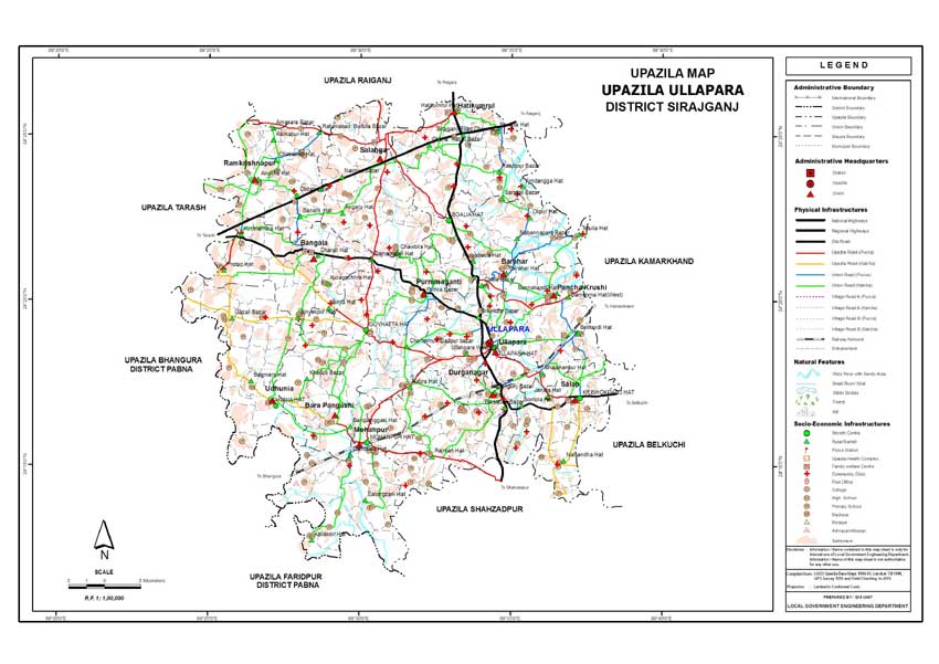
Ullahpara Upazila
Ullahpara Upazila (SIRAJGANJ district) with an area of 414.43 sq km,
is bounded by RAIGANJ upazila on the north, SHAHJADPUR upazila on the
south, KAMARKHANDA and BELKUCHI upazilas on the east and BHANGURA and
TARASH upazilas on the west. Main rivers are KARATOYA, Ichamati, Bilsuriya.
Ullahpara (Town) consists of 9 wards and 25 mahallas. It was
turned into a municipality in 1984. The area of the town is 12.70 sq
km. The town has a population of 36766; male 52.31% and female 47.69%.
Density of population is 2895 per sq km. Literacy rate among the town
people is 46.33%. The town has two dakbungalows.
Administration: Ullahpara thana, now an upazila, was established
in 1875. The upazila consists of one municipality, 13 union parishads,
263 mouzas, 433 villages.
Archaeological heritage and relics: Ancient Makkaulia Mosque
at Darogapara (fifteenth century), tomb of Hazrat Bagdadi (R) at Gaihatta,
tombs of Panch Pir at Angaru, Nabaratna Mandir at Hatikamrul (fourteenth
century).
Historical events: During the War of Liberation a battle was
fought between the freedom fighters and the Pak army on the Ghatina
Rail Way Bridge on 20 April 1971 of the upazila in which 20 members
of the Pak army were killed.
Marks of the War of Liberation Memorial monument at Ghatina.
Population: 399074; male 51.13%, female 48.87%; Muslim 93.87%,
Hindu 6.10%, Christian 0.01% and others 0.02%; ethnic nationals: Santal
13 families.
Religious institutions: Mosque 465, temple 17, tomb 5, sacred
place 2, most noted of which are tomb of Pagla Pir, tomb of Kalu Shah
Fakir (Satbaria) and tomb of Khawja Pir Nasiruddin (Ghoshgati).
Literacy and educational institutions: Average literacy 32.22%;
male 38.5% and female 25.5%. Educational institutions: college 13,
high school 47, junior high school 13, madrasa 116, technical training
institute 2, government primary school 146, non-government primary
school 105, music school 1, satellite school 10. Noted educational
institutions: Ullahpara Merchants Pilot Multilateral High School (1906),
Jhekra Bandar Model Government Primary School (1903), Lahiri Mohanpur
KM Institution (1915).
Cultural organisations: Club 50, cinema hall 5, theatre group
2, literary society 2, community centre 11 and women's organisation
130.
Main occupations: Agriculture 42.34%, agricultural labourer
26.14%, wage labourer 2.45%, commerce 10.85%, service 4.10%, transport
2%, weaving 3.94% and others 8.18%.
Land use: Total cultivable land 34912.18 hectares, fallow land
6525.70 hectares; single crop 25%, double crop 48% and treble crop
land 27%; cultivable land under irrigation 81%.
Land control: Among the peasants, 28% are landless, 32% small,
25% intermediate and 15% rich; cultivable land per head 0.08 hectare.
Value of land: The market value of the land of the first grade
is approximately Tk 7500 per 0.01 hectare.
Main crops: Paddy, jute, barley, wheat, mustard seed, onion,
sesame, and chilli.
Extinct or nearly extinct crops: Linseed, aus paddy, china,
kaun.
Main fruits: Mango, jackfruit, black berry, palm, coconut,
banana.
Fisheries, dairies, poultries Poultry 394, dairy 196, fishery 1963,
hatchery 14.
Communication facilities Roads: pucca 78 km, semi pucca 34 km
and mud road 591 km; railways 21 km, railway station 3; waterways 65
nautical mile.
Traditional transport: Palanquin, bullock cart and horse carriage.
These means of transport is either extinct or nearly extinct.
Manufactories: Ice factory 45, flower mill 1, cotton mill 2,
cold storage 1, welding 95.
Cottage industries: Weaving 2009, bamboo work 138, goldsmith
127, blacksmith 153, potteries 610, wood work 250, tailoring 325.
Hats, bazars and fairs: Hats and bazars are 31, most noted
of which are Ullahpara, Salanga, Gaihatta, Pratap, Binayekpur, Salop,
Barahar, Hatikamrul, Mohanpur Dharoil; fairs 5; Angaru Mela, Baruni
Mela (Simla), Dol Purnima Mela (Dharoil), Pashurara Mela (Banamali
Pratap) are noted.
Main exports: Jute, mustard seed, sesame, flour and vegetables.
NGO activities: Operationally important NGOs are BRAC, ASA,
PROSHIKA, THENGAMARA MAHILA SABUJ SANGHA, CARITAS, CARE, Srejani Palli
Unnayan Sangstha, Shishu and Nari Kalyan Sangstha.
Health centres: Hospital 2, satellite clinic 5, maternity and
child welfare centre 1, family planning centre 11. [Md Ruhul Amin]