


Political Empowerment of Women (in Local Government)
Pabna Sadar Upazila
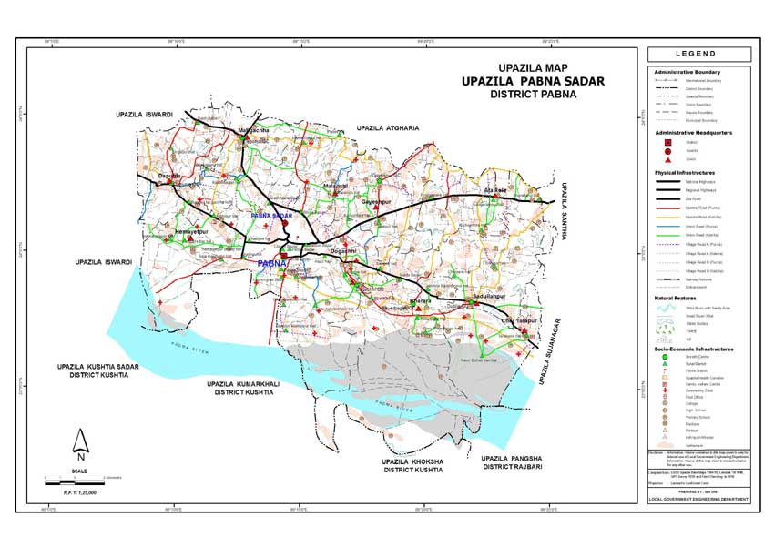
Pabna Sadar Upazila (PABNA district) with an area of 443.90 sq km, is
bounded by ATGHARIA and ISHWARDI upazilas on the north, KUSHTIA SADAR,
KUMARKHALI, KHOKSA and PANGSHA upazilas on the south, SANTHIA and SUJANAGAR
upazilas on the east, ISHWARDI upazila on the west. Main rivers are
GANGES and Ichamati; noted depressions: Sonapatil Beel and Tarapasha
Canal.
Pabna (Town) consists of 15 wards and 34 mahallas. The area of
the town is 18.64 sq km. The town has a population of 116371; male 52.37%,
female 47.63%. The density of population is 6243 per sq km. Literacy
rate among the town people is 60.1%. The only MENTAL HOSPITAL (estd
1957) of Bangladesh is located in the town.
Administration: Pabna thana, now an upazila, was established
in 1872. The upazila consists of one municipality, 15 wards, 10 union
parishads, 288 mouzas and 277 villages.
Archaeological heritage and relics: Three domed Mosque at Bharara
(1176 AH), 'Jor Bangala' or 'Jor Bangla' Mandir at Raghabpur (eighteenth
century), Tarash Bhaban (revenue office of Zamindar Roy Bahadur Banamali
Roy), Shitlai Bhaban (homestead of Zamindar Yogendranath Moitra),
Zamindar Bari (house) of Dhulai, District Judge Court Building (1884).
Historical events: A battle between the Pak army and the freedom
fighters was fought on 29 March 1971 at the telephone exchange compound
in which 22 members of the Pak army were killed.
Marks of the War of Liberation Mass grave: Central Shaheed Minar (Gopalpur);
memorial monument: Durjoy Pabna.
Population: 431513; male 51.76%, female 48.24%; Muslim 97.10%,
Hindu 2.85% and others 0.05%.
Religious institutions: Mosque 609, temple 120, church 1 and
sacred place 1, most noted of which Bharara Mosque, Jor Bangla Mandir
and Satsangha Ashram.
Literacy and educational institutions: Average literacy 29.1%;
male 32.2% and female 24.6%. Educational institutions: college 4,
high school 40, junior high school 11, madrasa 53, government primary
school 125, non-government primary school 58, community school 2,
kindergarten 21, cadet college 1, law college 1, government polytechnic
college 1, government vocational training institute 1, textile institute
1, government commerce college 1, primary teacher's training institute
1, nursing training institute 1, homeopathic college 1, Sanskrit toll
(Hemayetpur), music college 1. Noted educational institutions: Pabna
Edward College (1898), Pabna Zila School (1853), GC Institution (1894),
RM Academy (1899), Government Girl's High School (1925), Polytechnic
Institute (1891) and Aliya Madrasa (1925).
Cultural organisations: Club 81, public library 6, mosque library
87, cinema hall 5, literary and cultural organisation 32, theatre
stage 1, theatre group 13, community centre 1, shilpakala academy
1, voluntary organisation 203, women's organisation 84.
Locally published newspapers and periodicals Dailies: Uddag Bidhayani
(1863); Weeklies: Pabna Darpan (1864), Bartabaha (1882), Bramar (1882-83),
Usha (1882), Jostna (1900), Pabna-Bagura Hitoishi (1902), Suraj (1919),
Rawshan Hedayet (1924), Palli Pradip, Shahshata Sangbad, Tarjamanul
Hadith (1949), Manasi (1950), Pak Hitoishi, Amader Desh (1958), Pabna
(1967), Prabaha (1968), Mehanati Kantha (1972); monthly: Arati (1924).
Main occupations: Agriculture 25.27%, agricultural labourer
20.42%, wage labourer 5.43%, industrial labourer 2.07%, house building
2.33%, transport 4.61%, commerce 15.13%, service 11%, weaving 2.32%
and others 11.42%.
Land use: Total cultivable land 32168.35 hectares, fallow land
526.10 hectares; single crop 16.67%, double crop 33.30% and treble
crop land 50.03%; land under irrigation 22.43%.
Land control: Among the peasants 38.20% are landless, 27.45%
marginal, 17.14% small, 12.23% intermediate and 4.98% rich; cultivable
land per head 0.07 hectare.
Value of land: The market value of the land of the first grade
is Tk 6500 per 0.01 hectare.
Main crops: Paddy, jute, wheat, sugarcane, mustard, pulses
and mulberry tree.
Extinct or nearly extinct crops: Barley, indigo, kaun, bhura,
china and local variety of paddy.
Main fruits: Mango, banana, litchi, lemon and papaya.
Fisheries, dairies, poultries Dairy 48, fishery 13, poultry 328, hatchery
6.
Communication facilities Roads: pucca 270 km, semi pucca 30 km,
mud road 240 km; water ways 65 nautical mile.
Traditional transport: Palanquin, horse carriage and bullock
cart. These means of transport are either extinct or nearly extinct.
Manufactories: Major manufactories include pharmaceutical co,
biscuit factory, cotton mills, weaving factory, hosiery mill, rice
and flour mill, ice factory, welding etc.
Cottage industries: Weaving 5090, blacksmith 30, goldsmith
20, potteries 120, wood work 60.
Hats, bazars and fairs: Total number of hats and bazars are
12, most noted are Dogachhi, Tebunia, Kashipur, Dubalia Bazar; noted
fairs are Rathyatra Mela, Sadullahpur Beltala Mela and Hemayetpur
Mela.
Main exports: Hosiery good, cotton, cotton fabrics, paddy,
pulses and vegetables.
NGO activities: Operationally important NGOs are BRAC, ASA,
CCDB, Samata, TMSS, Sopan, Sarnali Mohila Samiti, Pragati, Suchana
and Assets.
Health centres: Mental hospital 1, zila sadar hospital 1, upazila
health complex 1, health & family planning centre 10, TB hospital
1, diabetic hospital 1, eye hospital 1, community hospital 1, maternity
& child welfare centre 1, police hospital 1, railway hospital
1, private clinic 15, school health centre 1, municipal health centre
1, seba hospital 1, family health clinic 1 and satellite clinic 11.
[Md Habibullah]